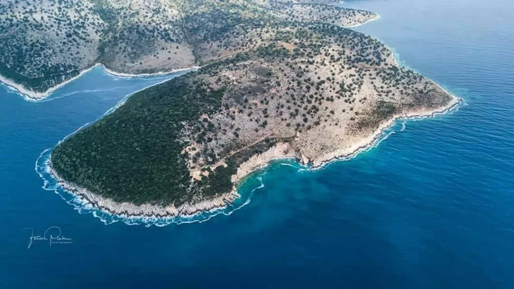
Cape Qefali is located approximately 11 kilometers northwest of the Port of Saranda, at coordinates latitude 39° 54′.5 N, longitude 19° 54′.6 E. The cape is a continuation of a ridge of hills, deviating from the general northwest coastal alignment and turning westward, ending at this prominent headland.
The name “Qefal”derives from its rounded shape, with the word “Qefal” meaning “head”in Greek. The elevation of the cape is 140.5 meters above sea level. It extends northwestward from the coastline for a total distance of 6 cables (approximately 1.1 km). The cape is covered with evergreen shrubs and sparse forest. At the western tipof the cape, a large rock formationstands 25 meters high, dropping steeply into the sea, forming a cave-like structure.
At the highest pointof the cape (140.5 m), there is a two-story stone building, visible from a great distance. The waters near the cape are deep and free from underwater hazards. The depth contours near the cape are as follows:
5-meter depth linelies 20 meters from the shore
10-meter depth linelies 50 meters from the shore
20-meter depth linelies 175 meters from the shore
50-meter depth linelies 325 meters from the shore
Qefali Lighthouse
The Qefali Lighthouse, located at latitude 39° 55′ N, longitude 19° 55′ E, stands near the existing stone building.
The structure is a metal pillar, 8 meters high, located to the right of the building.