Ftelia Bay is located at the southernmost tip of Albania, where the national border with Greece passes. The bay is a natural inlet that stretches inland, with an entrance width of about 5 cables (approximately 925 meters) facing north. It extends 4.5 cables (about 830 meters) eastward before curving south for another 3.5 cables (around 650 meters).
Throughout its length, the shores of the bay are rocky and steep, forming cliffs that descend sharply into the sea. On the eastern side of the bay, a mountain stream flows into the water. During periods of rain, this stream carries large volumes of water and deposits solid material at its mouth.
The bay is quite deep. The 5-meter depth contour lies 50–70 meters from shore, while in the southeastern end it extends even farther—200 to 225 meters from the coast. The 10-meter depth contour moves eastward into the bay but stops about 250 meters before the bay’s southern turn.
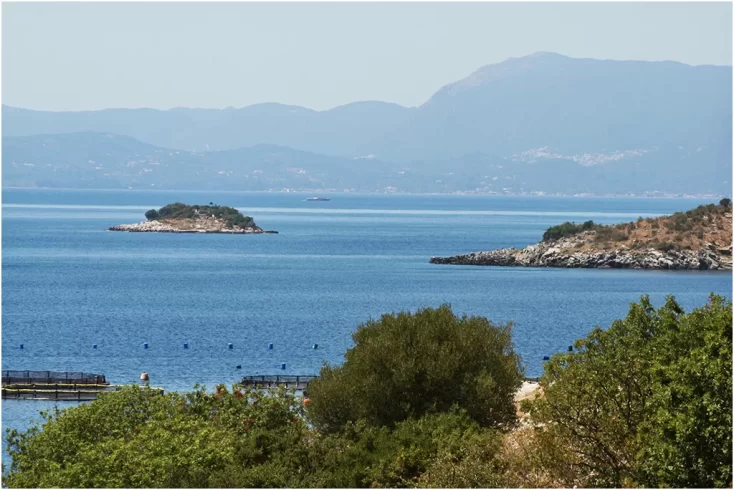
At the entrance of Ftelia Bay lies Tongo Island, a rocky island stretching northwest to southeast, about 250 meters long and over 100 meters wide. Depths north of the island are greater than those to the south. The 5-meter depth line north of the island is found 20–25 meters offshore, while to the east it is 45–50 meters from the shore.
Tongo Island is entirely within Albanian territory. The bay offers shelter for small boatsfrom all wind directions, although larger vesselsmay find it exposed to southern and southwestern winds.
Fokianos Strait
The Fokianos Strait is formed by Cape Stilloand the cape east of Fokianos. It extends inland for 4 cables (about 740 meters) to the north, with an entrance width of 2 cables (around 370 meters). The waters in the strait are deep and navigable, with the 5-meter depth contour lying 20–25 meters from the shoreline.